
The biggest cyclone "in living memory" is set to be unleashed on northern Australia, sounding alarm bells for flooded regions.
Tropical Cyclone Narelle is barrelling toward far north Queensland and could impact the coast as a dangerous category five system, inflicting winds up to more than 250km/h.
The monster system is tipped to cross near Coen, north of Cairns on Friday, triggering evacuations with warnings it could tear off roofs and propel debris at deadly speeds.
"This may be the biggest system that many people have seen in living memory," Queensland Premier David Crisafulli warned on Wednesday.
“It's a serious situation and the window to act is obviously closing."
It it shaping to be the first category five system to hit Queensland since Cyclone Marcia in early 2015.
Damaging wind gusts of up to 155km/h are expected to start bombarding the far north from Thursday.
Late on Wednesday, Cyclone Narelle was sitting northeast of Cairns as a category three system after forming in the Coral Sea.
It is predicted to cross Cape York, then onto the Northern Territory's Top End coast before moving into Western Australia's Kimberley coast.
"At the estimated category five crossing, we should not underestimate the potential for the loss of life," Queensland state disaster co-ordinator Chris Stream said.

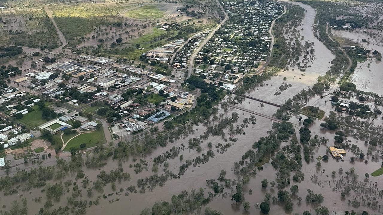
It is the third system to impact the sodden Queensland region in barely two months after two lows struck, causing widespread flooding.
State and federal government-backed disaster support packages were released on Wednesday, totalling $107 million.
Locals are battening down the hatches as the system approaches.
“This is not the opportunity for you to be outside during the cyclone, getting that TikTok moment - do not do it," Mr Stream said.
"A piece of debris being propelled at over 100 km/h will kill you."

More than 100 emergency personnel were deployed north as people were evacuated at Port Stewart, near Coen, as well as a luxury resort at nearby Lizard Island.
A cyclone watch zone has been declared from Lockhart River on the Cape York Peninsula to the Port Douglas region.
Emergency alerts were issued on Wednesday across the zone, warning locals to "prepare now".
"This is a cyclone watch and act. Secure belongings, warn others and plan a safe shelter," it said.
The destructive system is set to saturate the far north coastline with up to 450mm of rain as it approaches, along with the damaging winds.
"We are expecting to see property damage, roofs being torn off houses and businesses as well as trees being stripped and power lines cut down," the Bureau of Meteorology's Jonathan How told AAP.
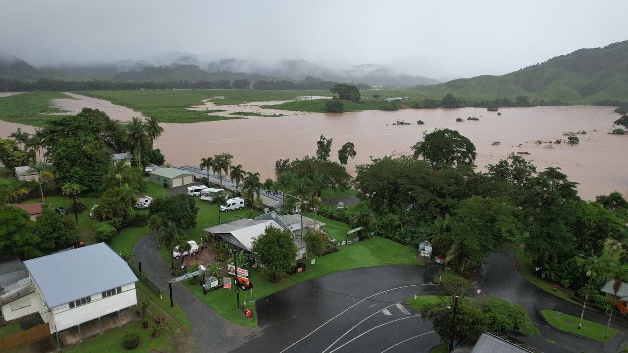
Flood watches were in place south to Cairns and Ingham.
"We're asking people to prepare for waves, for wind, for rainfall, for flooding, but communities will get through it if they do those preparations," Mr Crisafulli said.
Cyclone Narelle will drench already-swamped NT communities, including Katherine which is still recovering from its worst floods in almost 30 years.
Almost 600 people from the flooded NT communities of Daly River and Palumpa are still in emergency shelters in Darwin and Mataranka.
"I think everybody's just holding their breath at the moment, hoping that it just dissipates or goes around," Katherine Mayor Joanna Holden told AAP.
Cyclone Narelle was expected to cross into the NT as a category three system on Sunday, producing winds up to 159km/h and yet more rain.
Weary NT locals were urged to take the cyclone threat seriously.
"We know that it's starting to get tedious ... but we really need you to keep your focus going and prepare," NT Incident Controller Kirsten Engels said.
RECENT CATEGORY FIVE CYCLONES TO HIT AUSTRALIA:
* ILSA (April 2023) - Crossed Western Australia's north coast, claiming eight lives and producing Australian record wind speeds of 289km/h
* MARCIA (February 2015) - Made landfall at central Queensland's Shoalwater Bay, causing $90 million-plus damage to Yeppoon and Rockhampton
* YASI (February 2011) - Wiped out almost a billion dollars worth of crops and agriculture after hitting Mission Beach, south of Cairns. Man sheltering inside with his generator was asphyxiated by fumes
* GEORGE (March 2007) - Hit the NT and WA, causing three fatalities and $6 million worth of damage
* MONICA (April 2006) - Wiped out a weather station and caused at least $6 million of damage despite crossing Cape York in a remote location


