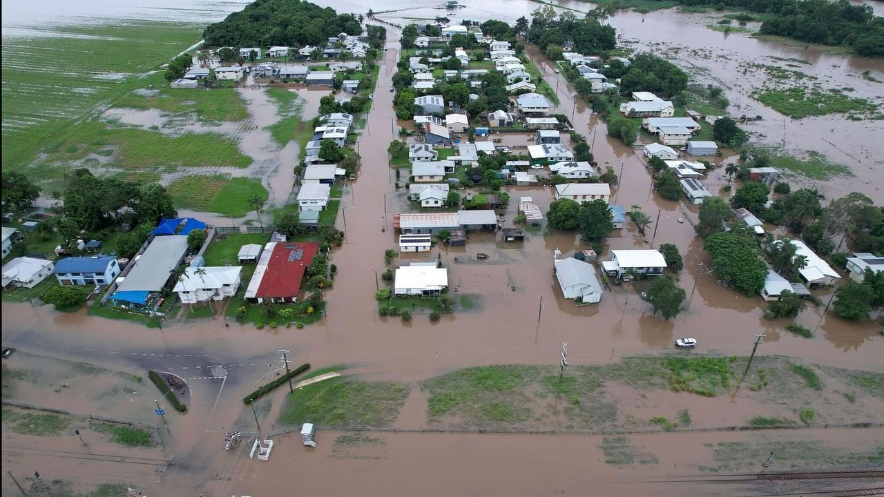
The clean-up is just beginning for flood-stricken farmers facing a hard road ahead after weeks of torrential rain.
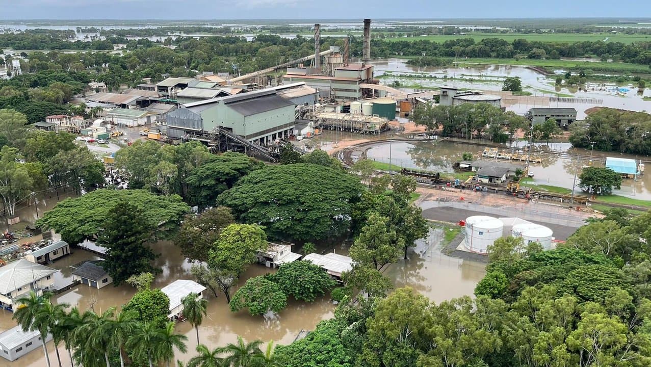
Sugarcane, avocados, bananas, fishing and livestock have all been hit hard by the wet weather that has plagued north Queensland, claiming two lives.
Farmers would not know the true extent of the damage until floodwaters receded, AgForce CEO Shane McCarthy said.
He said it would depend on the crop's stage whether it was harvested or a farmer was back to square one.
A destroyed crop may lead to shortages and a price spike for consumers but the impact would be far greater on farmers, Mr McCarthy said.
"Farmers are pretty resilient, that's why they're in farming. It takes a special breed," he told AAP.
But with successive wet seasons, Cyclones Jasper and Kirrily impacting the north within a month by early 2024 and now the floods, it will take a toll.
"People in North Queensland will often say a cyclone is devastating but it comes and it goes relatively quickly," Canegrowers CEO Dan Galligan told AAP.
"Floods are very insidious things, when you're looking at 10 to 12 days of damage before you can even start to think about what you need to do, to rebuild is pretty hard."
More rain has been forecast in the north from Cape York Peninsula, down the tropical coast and into the Burdekin region, with 24 hour totals of up to 200mm before easing on Wednesday.
But Mr Galligan warned there could be more rain to come.
"It's actually still pretty early in February, so this is still a wet season, so we don't know what's going to come around the corner," he said.
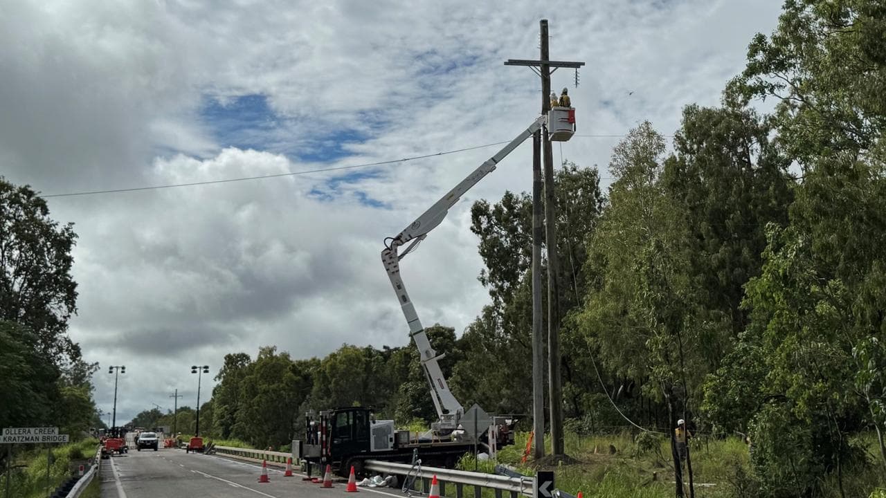
As farmers try to take stock of the damage, recovery efforts are underway with key roads reopening to help provide critical supplies and support to flood-stricken towns.
A critical thoroughfare - the Ollera Creek Bridge on the Bruce Highway north of Townsville - was destroyed by floodwaters, cutting off towns like sodden Ingham.
Hundreds of trucks have passed across the rebuilt bridge after it reopened to heavy vehicles.
"It's fair to say genuine relief is starting to be provided into far north Queensland," Queensland Trucking Association's CEO Gary Mahon told AAP.
About 200 trucks have been waiting for days at Townsville for roads to reopen, with companies reportedly losing up to $100,000 a day.
But with other road closures like the Macrossan Bridge near Charters Towers, nearly 100 trucks are still waiting to deliver their goods.
Mr Mahon was hopeful the trucks would be on their way in the next 24 hours.
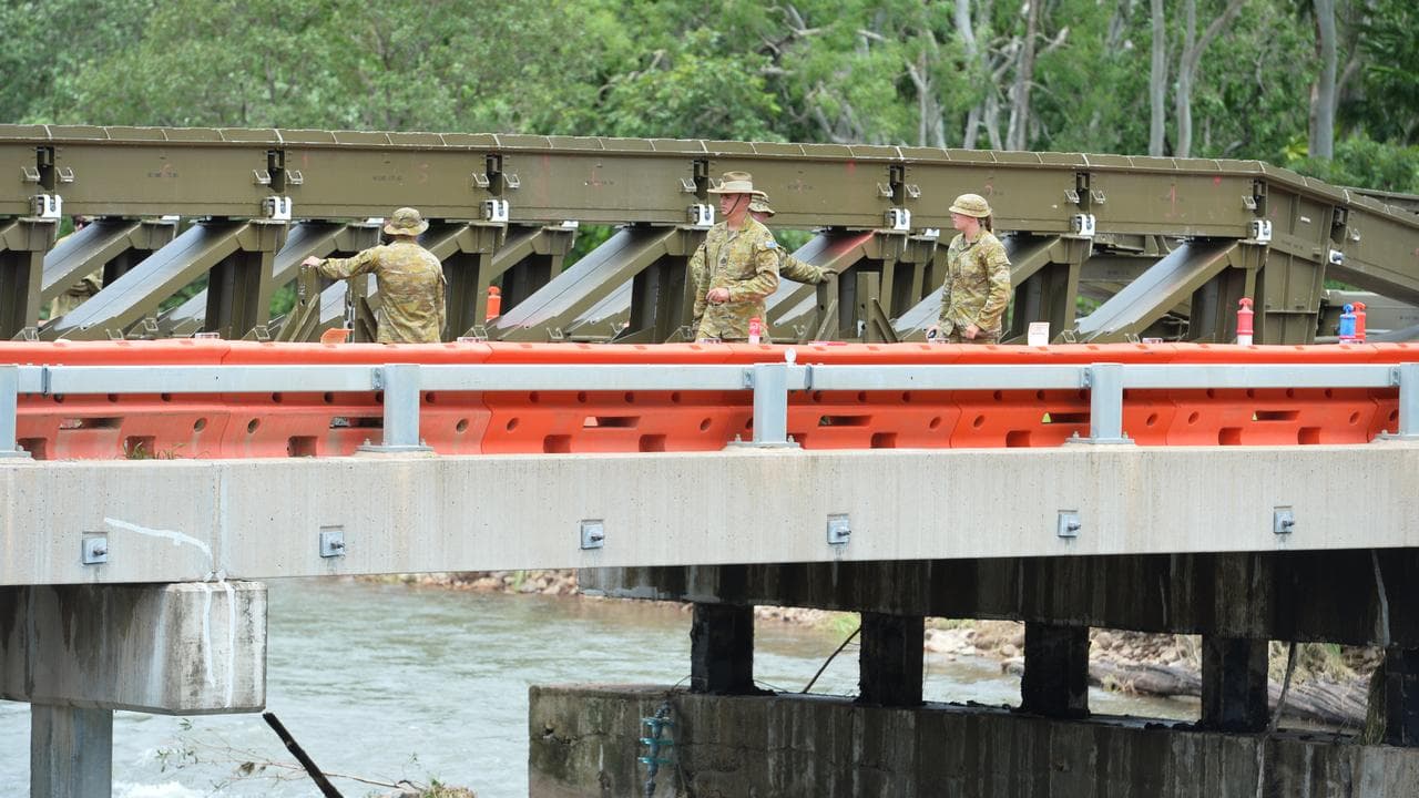
The Ollera Creek Bridge is set to reopen to the public in another shot in the arm for the Ingham community.
Ingham is beginning to recover after being completely isolated, with two lives lost in floodwaters.
There was another scare after two men went missing after allegedly driving into floodwaters near Ollera Creek to go fishing late on Monday night.
"The wisdom of that decision would definitely be in question," Acting Inspector Graeme Paterson said.
One man was able to seek help and the other was later found by rescue helicopter.
Some regions may take some time to recover with at least six Gulf communities cut off by floodwaters.
In NSW, a severe thunderstorm warning was issued for east of Dubbo with more possible across the state's east, including Sydney, after a flash flooding event.
And in Western Australia, Tropical Cyclone Zelia is set to form off the northwest Kimberley coast.
Heavy rain and strong winds were expected in parts of the Pilbara and Kimberley.


