A sodden town has been warned it is "not out of the woods yet" despite avoiding significant further damage from a fast-moving storm.
The Northern Territory on Monday farewelled former tropical cyclone Narelle as it barrelled toward Western Australia, triggering rain and wind warnings as it headed into the Kimberley.
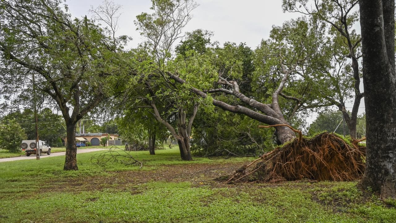
Trees were toppled and power was cut across the Top End but the system caused less damage as it travelled west than was first feared.
"It moved a lot quicker than we were expecting, which is great news for the territory ... there is much less damage than what we were expecting due to those fast speeds," NT Chief Minister Lia Finocchiaro said.
However, Ms Finocchiaro warned Katherine, southeast of Darwin, was "not out of the woods yet" as the town braced for more flooding in Narelle's wake.
Katherine homes and businesses are still reeling from floodwaters earlier in March after heavy rains filled catchments in the Big Rivers region.
Warnings remain in place for the nearby Katherine River, which was set to reach moderate flood levels later on Monday, potentially inundating roads and some buildings.
Major flood warnings are current for the Adelaide, Daly and Waterhouse rivers as Narelle - now classified as a tropical low - heads toward WA.
Katherine Mayor Joanna Holden said her community was better prepared this time around after a major sandbagging effort.
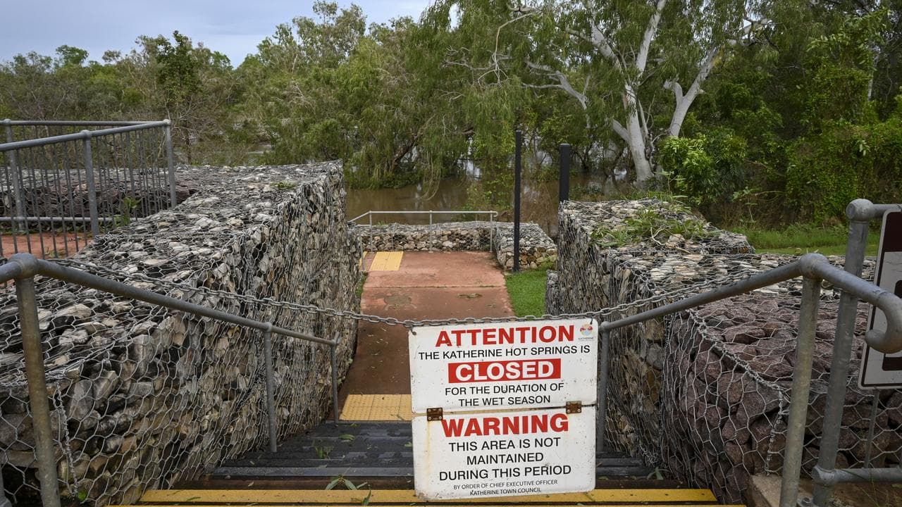
There were no heavy downpours overnight and falls in the river catchment area had mostly been less than 100mm, she told AAP on Monday.
"So I think people are feeling mildly optimistic, but ... we can't become complacent."
The power was off and a boil-water alert was issued in Adelaide River, where the major flood level was reached and residents self-evacuated overnight after four homes were inundated.
"There are a couple of big trees down and certainly water has been lapping the pub there and the service station," Ms Finocchiaro said.
Hundreds of people airlifted to safety from the Gulf of Carpentaria community of Numbulwar will begin returning home from Monday afternoon after assessments showed the passing storm caused minimal damage.
But the Daly River township, northwest of Katherine, remains underwater with more flooding expected as hundreds of evacuated residents wait in emergency shelters in Batchelor, south of Darwin.
Flood watches were still in place and a coastal hazard warning had been issued for damaging surf for the NT's western coast, including Darwin.
NT Police Commissioner Martin Dole said emergency services were monitoring river systems.
He warned drivers not to try to cross flooded roads including the Stuart Highway.
Narelle weakened to below cyclone strength after crossing the coast in remote eastern Arnhem Land on Sunday, with trees down but no reports of major damage in Gulf communities.
The ex-cyclone is forecast to continue its path into WA, bringing heavy rain and damaging wind gusts to northern parts of the Kimberley.
Catchments were already saturated across the region, meaning rivers and creeks would rise quickly with heavy rainfall, the Bureau of Meteorology said.
Roads could be affected and some communities might become isolated, it warned.
The clean-up is continuing in far north Queensland after Narelle struck on Friday.
State schools have reopened and power is being restored across the remote region after the cyclone uprooted trees and blew off roofs, causing little structural damage.
Police have delivered fuel to Cape York communities to help locals recover from the storm.
"The community's dodged a bullet, big time," Lockhart River Mayor Wayne Butcher said.


