
A massive reformed cyclone barrelling toward the mainland could reach maximum storm strength as it skirts a series of isolated coastal communities.
Tropical Cyclone Narelle was upgraded on Thursday to a powerful category four system off Western Australia's northwest coast.
The storm is on track to cross late on Friday in the Shark Bay area and could intensify to category five as it cuts a path past Exmouth, Coral Bay, Denham and Carnarvon towards the coastline.
"You are looking at widespread, destructive winds that are going to cause significant damage across many buildings and homes throughout the impacted area, should it be at category five," Department and Fire and Emergency Services Commissioner Darren Klemm said.
The system is expected to become a category three storm before it crosses the coast.
Category five storms are extremely dangerous with widespread destruction and wind gusts of more than 279km/h while category three systems can bring very destructive winds, with gusts of up to 224km/h.
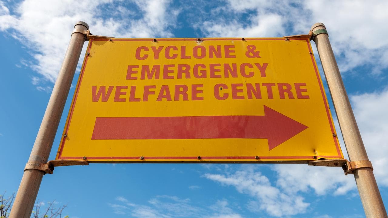
Tourists have been told to leave the region, major roads have been closed, and evacuation centres have been set up ahead of Narelle's arrival.
Meteorologist James Ashley said Narelle was an unusual and large storm.
"The system is packing winds well over 200km/h at the moment, and all those coastal places between Exmouth and Shark Bay can expect those severe wind impacts as well as that heavy rainfall," he said.
Some locations could receive more than 200mm of rainfall and flash flooding, with significant storm surges possible.
Shark Bay shire president Peter Stubberfield said volunteers had been busy sandbagging ahead of a possible tidal surge in the tiny holiday town of Denham on the Peron Peninsula, 830km north of Perth.
"We're preparing for the worst ... and we're hoping for anything less than that," he said.
Tackle shop manager Barry Taylor said Exmouth residents had worked hard "getting everything as locked down or strapped up and as safe as we can" ahead of Narelle's arrival.
"Fingers crossed we don't cop it too hard," he said.
The town of about 3000 people was devastated when the category five Tropical Cyclone Vance slammed into it on March 22, 1999.
"You've got a lot of people in this town that went through Vance," he said.
They're the ones probably most wary - quite a few that haven't seen a decent cyclone either."
Narelle's epic journey across northern Australia began when it first crossed the coast in Queensland as a category four system on Friday, moving over the Cape York Peninsula.
It left a trail of power outages and flooding as it hit the NT as a category three by Sunday, forcing hundreds of people to evacuate.
After initially crossing northern WA as a tropical low on Monday, Narelle has gained strength in the Indian Ocean, heading southwest along the Pilbara coastline.
It is producing gusts of up to 230km/h and is located about 365km northeast of Exmouth.
The system is set to move southeast after crossing the coast and pass as a tropical low east of Perth on Saturday, bringing showers and thunderstorms, before heading into the Southern Ocean on Sunday.
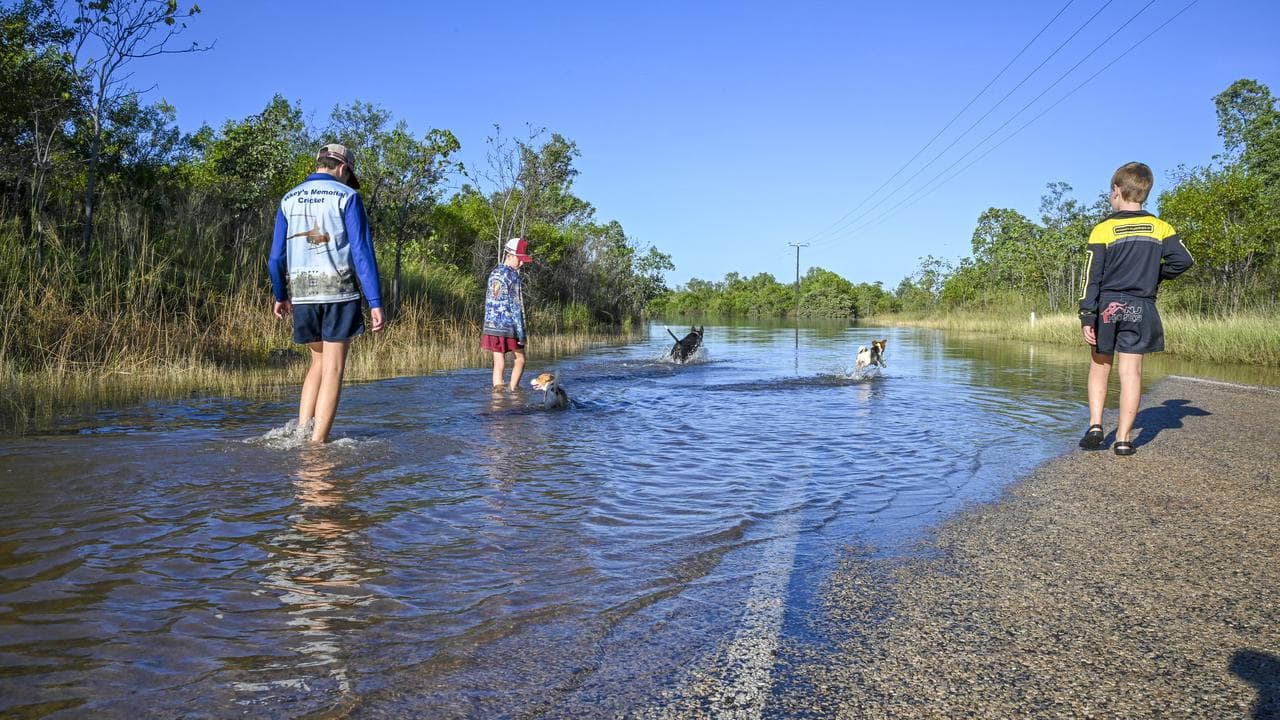
Some homes in the NT town of Katherine have been inundated for the second time in a month after Narelle dumped heavy rain in the region.
Emergency shelters have been prepared to take evacuees and a portable field hospital has been set up after the town's hospital was closed.
The Katherine River was expected to peak just above the major flood level of 17.5 metres at the town bridge on Thursday.


