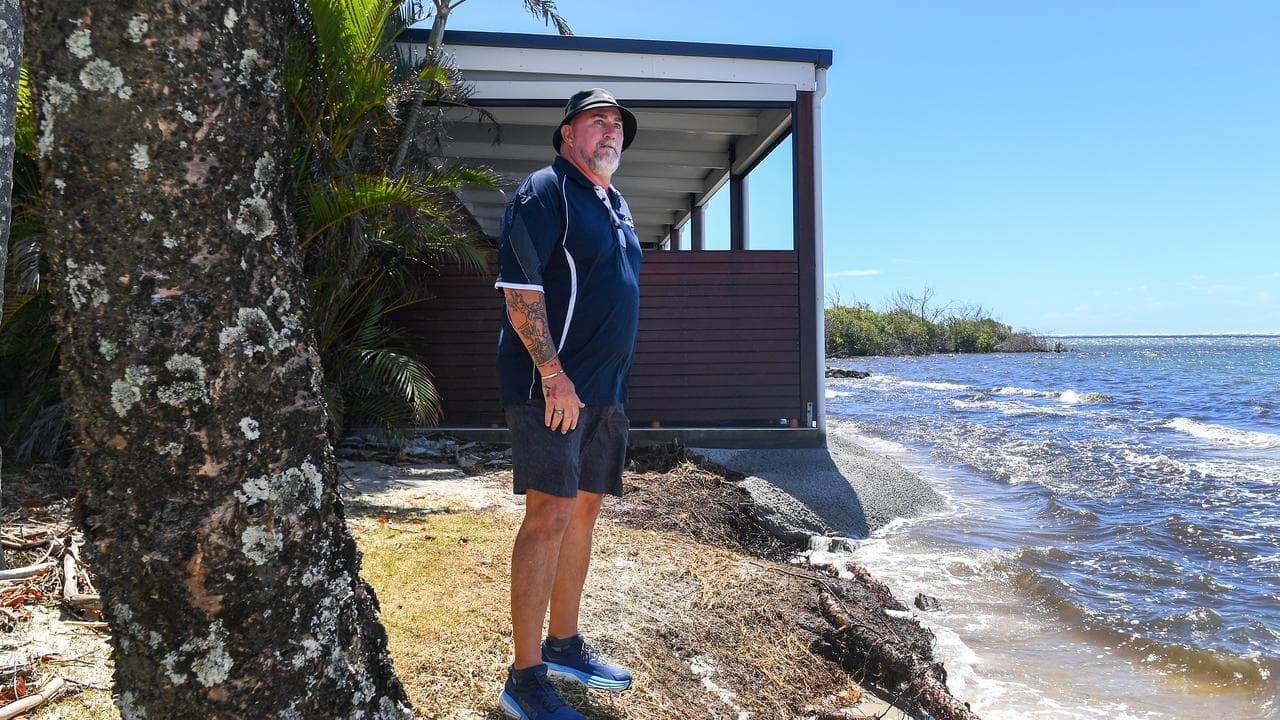
A 20-metre stretch of grass usually separates the Caloundra Power Boat Club from the water.
But waves were on Tuesday lapping at its floor as Tropical Cyclone Alfred zeroed in on Queensland's southeast coast.
Water has slowly crept closer to the beloved Sunshine Coast venue in the countdown to Alfred, breaching the club floor and leaving debris strewn across the ground.
The venue has found itself exposed to the elements, denied the protection of Bribie Island's slowly eroding northern tip.
Club manager Shane Anderson is bracing himself with Alfred expected to cross between Brisbane and the Sunshine Coast late on Thursday or early Friday as a category two system.
It will mark the first time a cyclone has hit the southeast Queensland coast since 1974.
"The next 48 hours is going to be quite negative," Mr Anderson told AAP.
Not everyone shared his concerns, with a group of women playing mahjong at the club while in the car park there was a flurry of sandbagging activity.
"People are just trying to be out doing their daily business at the moment and I hope they don't get caught out," Mr Anderson said.
Growing up in the far north, Mr Anderson knows cyclones can be dangerous.
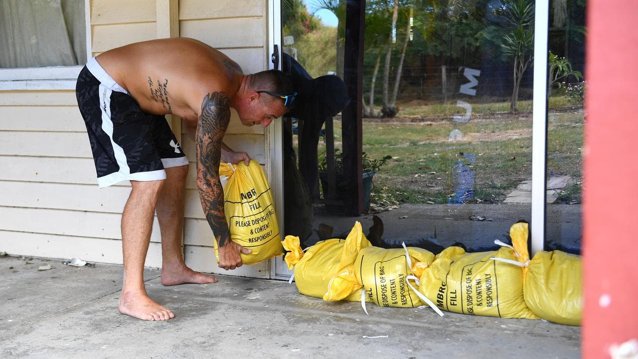
The club has been sandbagged inside, with windows taped and furniture tied down to ensure it does not become projectiles in damaging winds.
He kept his fingers crossed it would be all for nothing.
"I'm hopeful that on Friday we're going to go 'we did all that work for nothing' and that is the best-case scenario," he said.
But forecasts suggest Alfred may pack a punch.
Located 600km east of Brisbane, it is expected to turn towards the Queensland coast on Tuesday night and trigger destructive winds, heavy rainfall and flooding as it approaches.
The worst of Alfred's impact once it makes landfall will hit the state's southern flank, including Brisbane, the Gold Coast and NSW's Northern Rivers which has only just recovered from deadly floods three years ago.
"This is the last thing that they want to hear but we are asking them to be prepared ... for the worst and hope for the best," NSW Premier Chris Minns told ABC News.
The prime minister was set to fly into Brisbane on Tuesday night, with the federal disaster response plan activated and a crisis co-ordination team to be deployed as the region braces for impact.
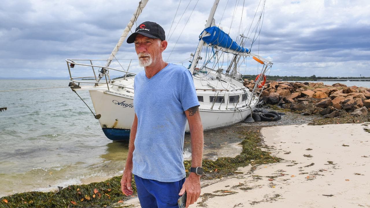
Alfred was on Tuesday generating significant swell as it approached, with reports of waves taller than seven metres.
Queensland's southeast was expected to be lashed by 100mm of rain on Wednesday and up to 400mm by the time Alfred crossed the coast.
Schools remain open but beaches, university campuses and Gold Coast theme parks are set to close along with ferry services as the region bunkers down.
Emergency services, telco providers and Energex crews have bolstered the region with evacuation centres on the Gold Coast to open from Wednesday night.
Communities in the firing line stepped up preparations on Tuesday, with many queuing for hours at sandbagging sites.
"There was no real order in getting the sandbags it is just like, once they have dumped there everyone is like vultures," Matthew Formosa told AAP about Morningside's depot.
About 150,000 sandbags have been collected in the past three days across southeast Queensland.
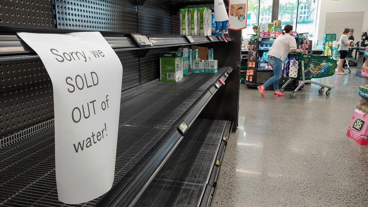
Supermarket shelves have been stripped bare in some stores amid panic buying, prompting the state government to allow grocers to trade 24/7 in 21 local government areas.


